Pohnpei is a mountainous volcanic island in the middle of the Pacific. It belongs to the Caroline Archipelago. The island is surrounded by a reef and covered in dense rainforest. The highest point is 791 meters above sea level. With an area of 334 km², Pohnpei is also the largest island in the Federated States of Micronesia.
In this article you will find our best photos, and the exact locations are marked on the map.
If you want to learn more about Pohnpei, check this out: Pohnpei Guide
Table of Contents
Show more
Map of the photo spots
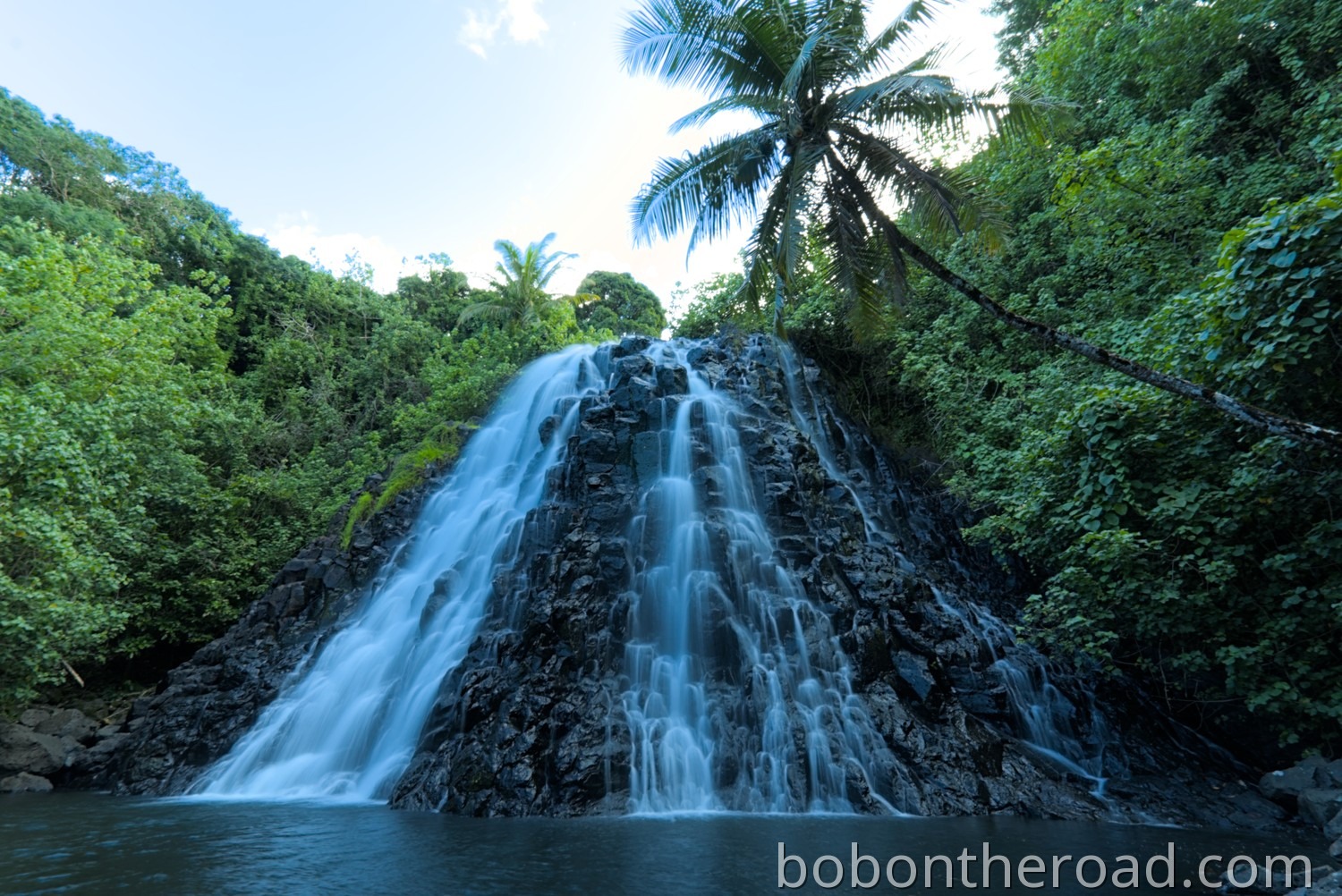
Kepirohi Waterfall
One absolute highlight on Pohnpei is Kepirohi Waterfall in the southeast of the island, not far from Nan Madol. The waterfall is 20 meters high and 30 meters wide. What makes it special is that the water makes its way over sharp edged basalt blocks. A pool has formed below the waterfall where swimming is allowed.
There is a small parking area on the main road. From there, it is about a five minute walk along a trail to reach the waterfall.
The parking area is marked on the map.
Access to the waterfall is via private land, and the owners charge an entrance fee of 10 USD per person.
Nan Madol
One of the highlights on Pohnpei is Nan Madol. The ruined city was built around the 12th century by the Saudeleur Dynasty. The complex stretches across almost 100 small artificial islets connected by canals. Nan Madol was not used as a residential area, but served political and ritual purposes.
Nan Madol has been a UNESCO World Heritage Site since 2016, but it is considered endangered. Rising sea levels and the resulting coastal erosion are taking a toll on the site.
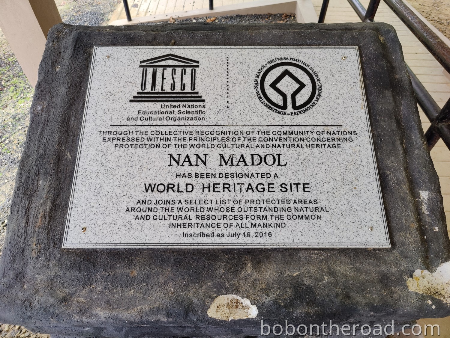
Photo tip:
Nan Madol is quite spread out, so the best photos can be taken with a drone. Unfortunately, we destroyed our drone in Majuro and were therefore unable to take aerial shots of Nan Madol.
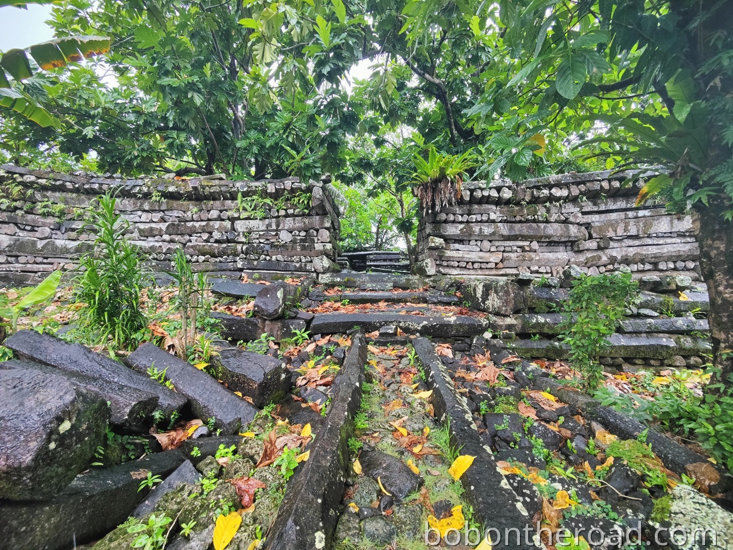
The way to Nan Madol is not well signposted. There is a visitor center, but from there you do not reach the actual ruins directly. From the visitor center, drive back about 400 meters and then take the first left. Follow this road for about 500 meters and then turn left again. The access road is only a few hundred meters long, but very steep and unpaved. About four to five cars can park here.
From there you continue on foot. You first pass a small house, more precisely through the garden, and behind it the trail begins. The path leads through the mangroves, and after about 10 to 15 minutes you reach the ruins.
Access is via private land, so an entrance fee is charged. We paid 5 USD per person, but we also heard from others that they had to pay 25 USD per person.
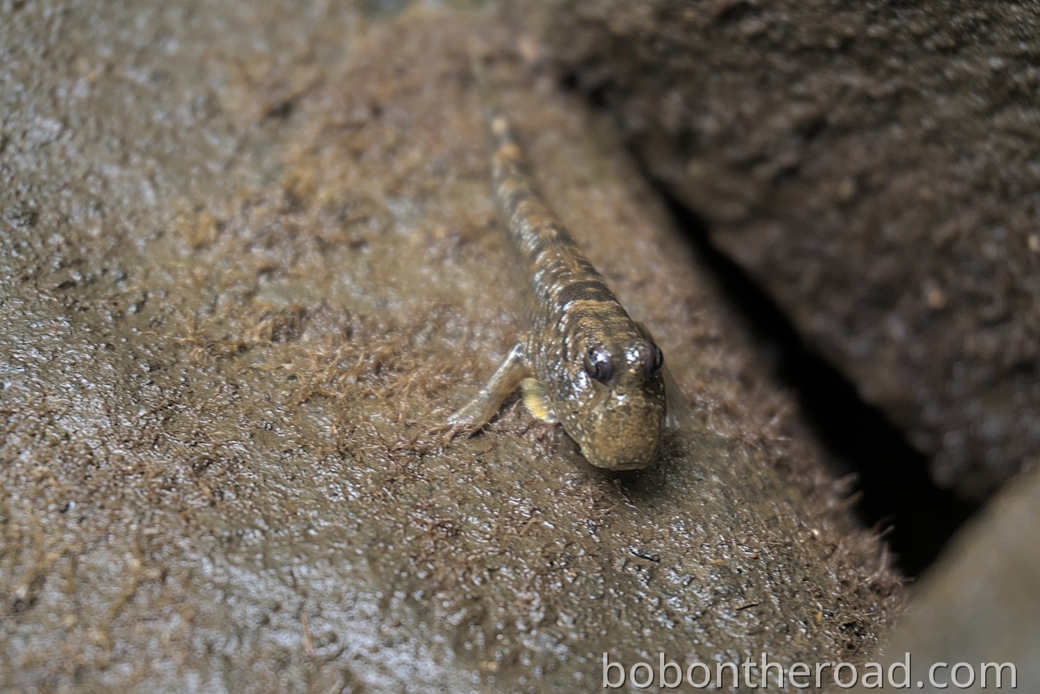
Mangroves
Around Nan Madol there is a mangrove forest. A narrow path leads through the forest, but it can be slippery and wet. Walking time is about 10 to 15 minutes.
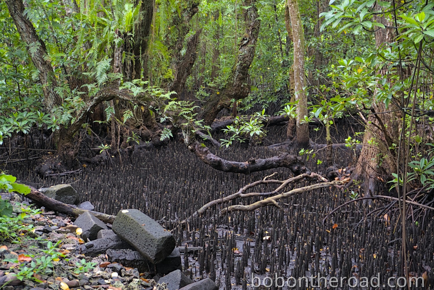
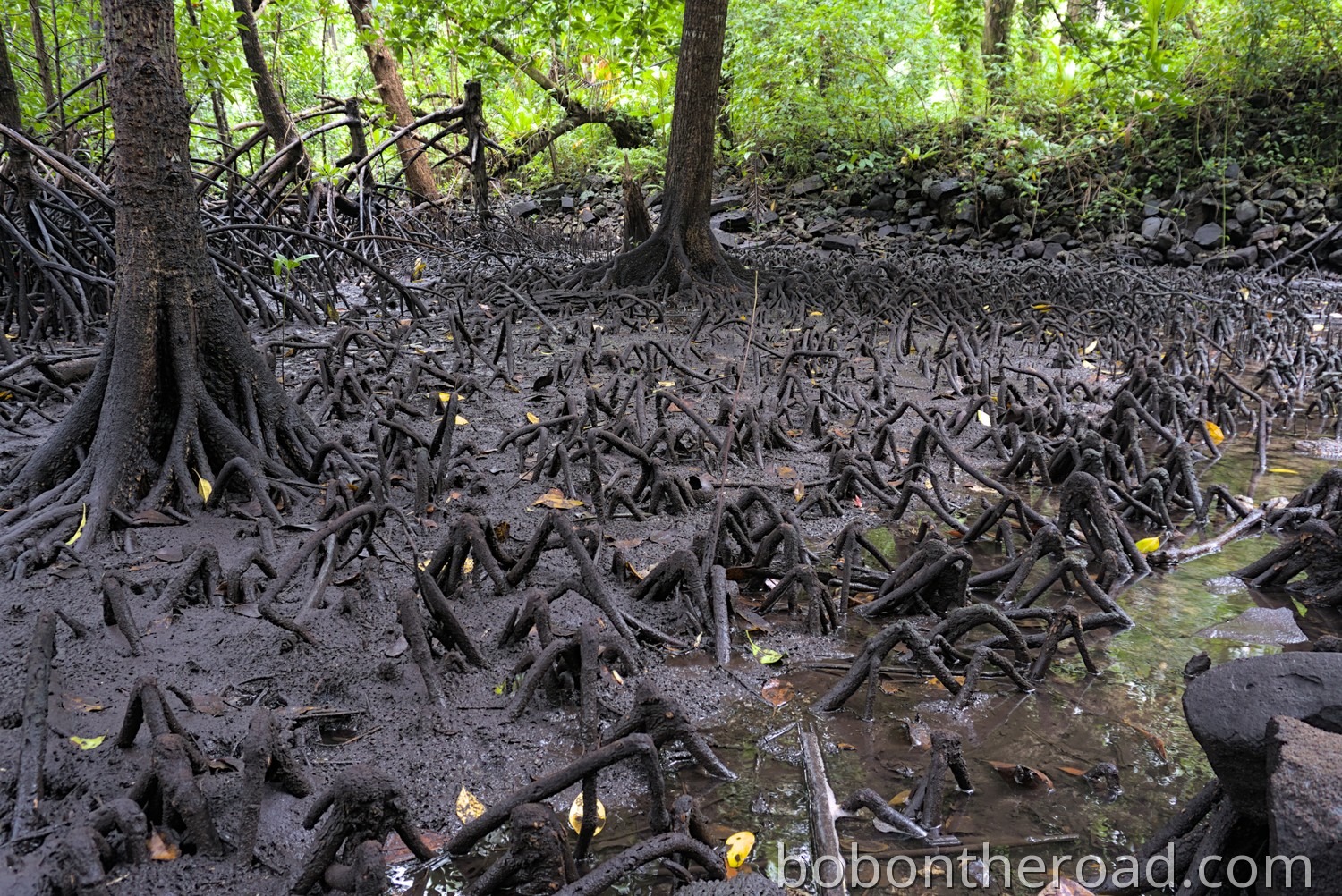
Mudskippers live in the mangroves. These fish can breathe through their skin, which allows them to survive on land.
Liduduhniap Waterfall
Liduduhniap Waterfall, also known as Twin Waterfall, is another one of the best known waterfalls on Pohnpei. Liduduhniap consists of two waterfalls, a smaller upper one and the main lower waterfall. There is also a small picnic area.
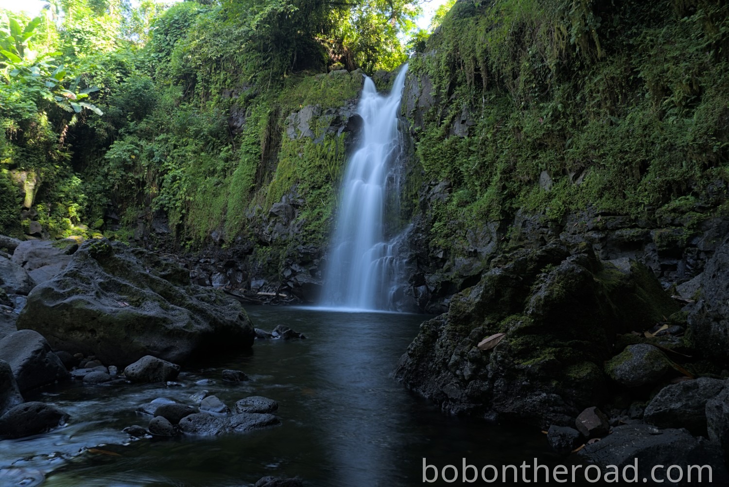
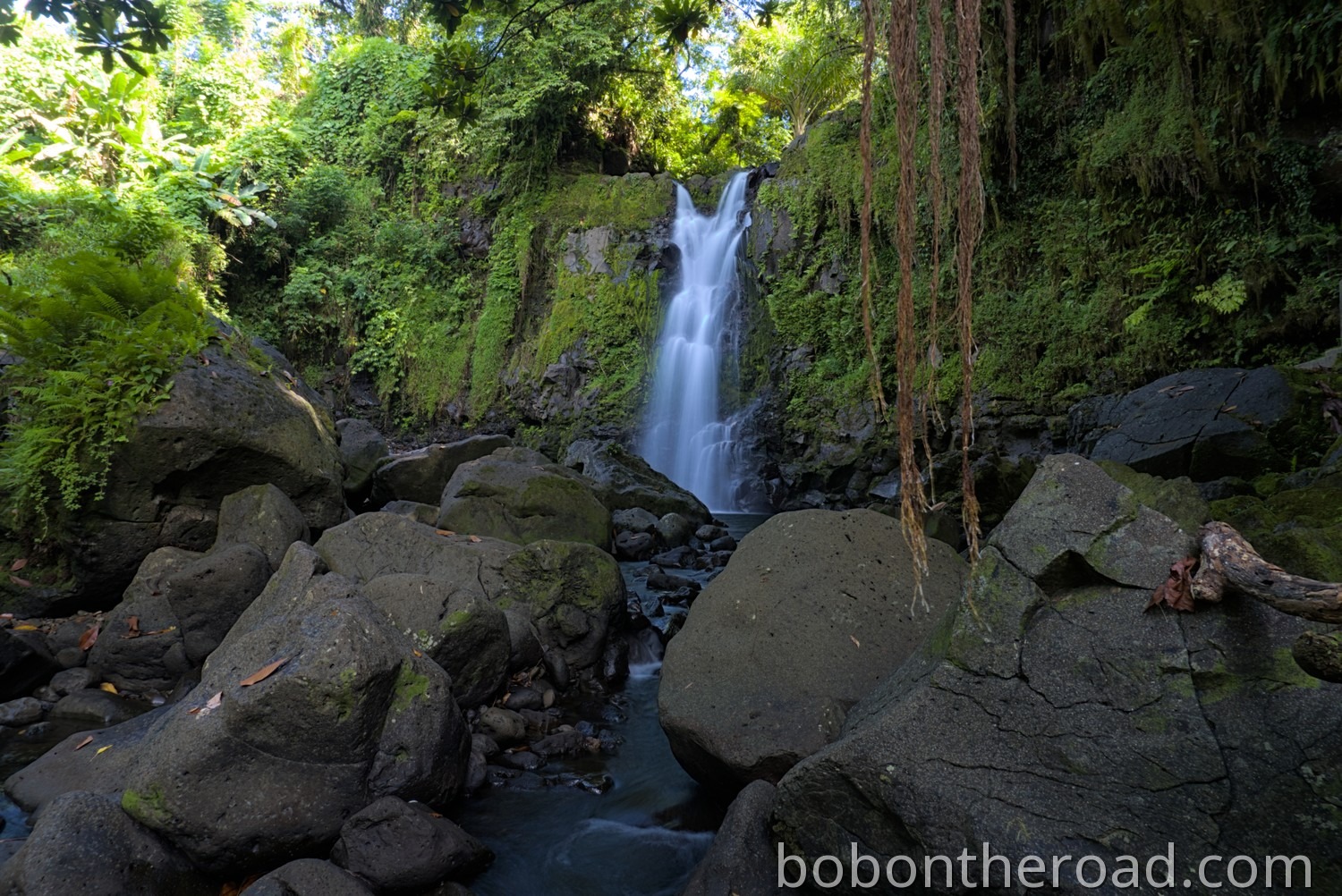
The waterfall is about 7 kilometers from Kolonia and easy to reach via a small road. However, the road is not in great condition and has lots of potholes. From the parking area, a short trail of a few hundred meters leads through the rainforest to the waterfall.
Important: The waterfall is a popular swimming spot. During heavy rain, dangerous flash floods can occur. At the start of the trail there is a memorial for three tourists who were swept away in a flash flood in 2002 and died.
The trail crosses private land, and 3 USD per person must be paid.
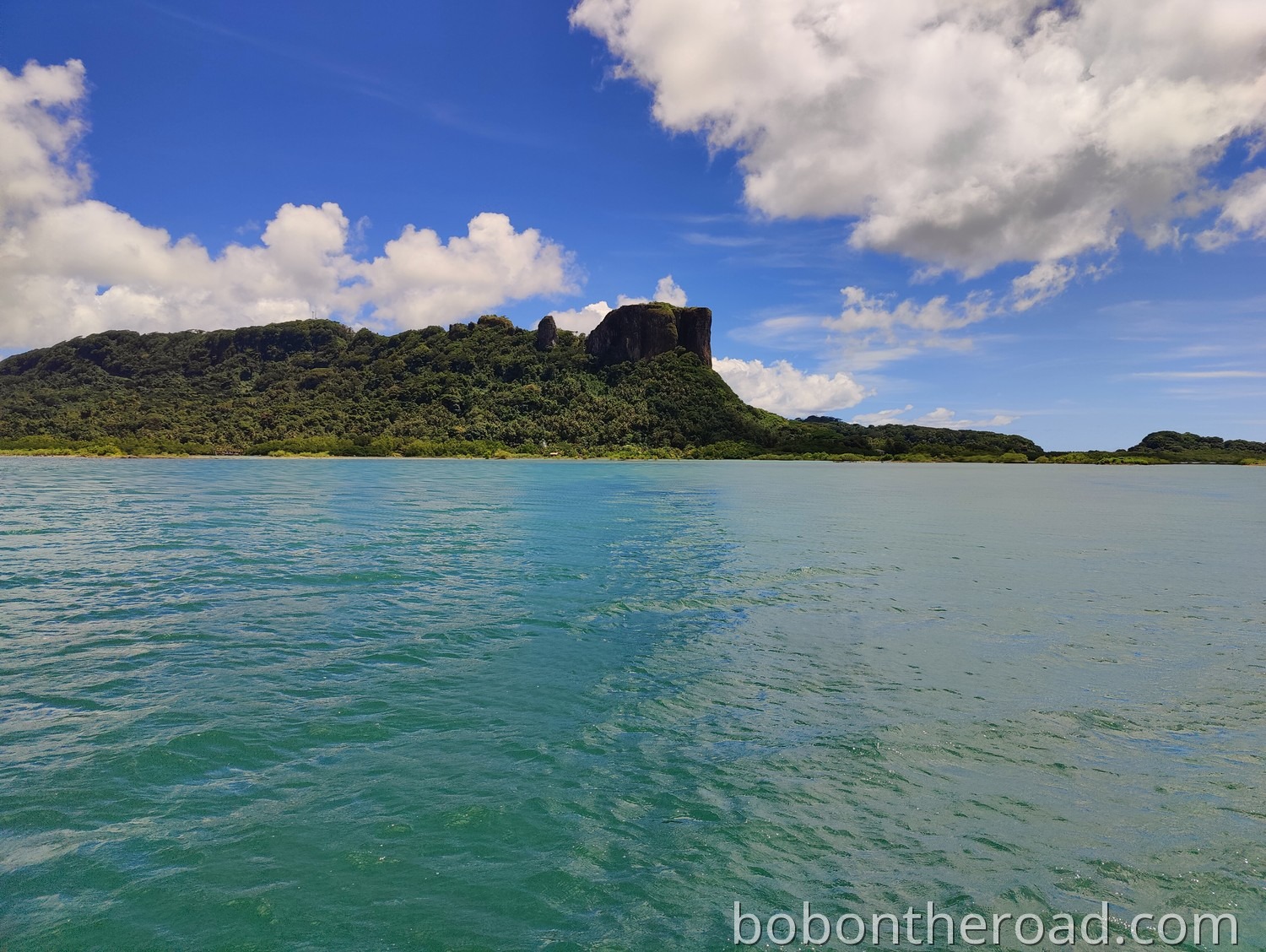
Sokehs Mountain
Sokehs Mountain is a rock formation on the island of Sokehs. The rock is clearly visible from Kolonia and rises 276 meters above the harbor and the airport.
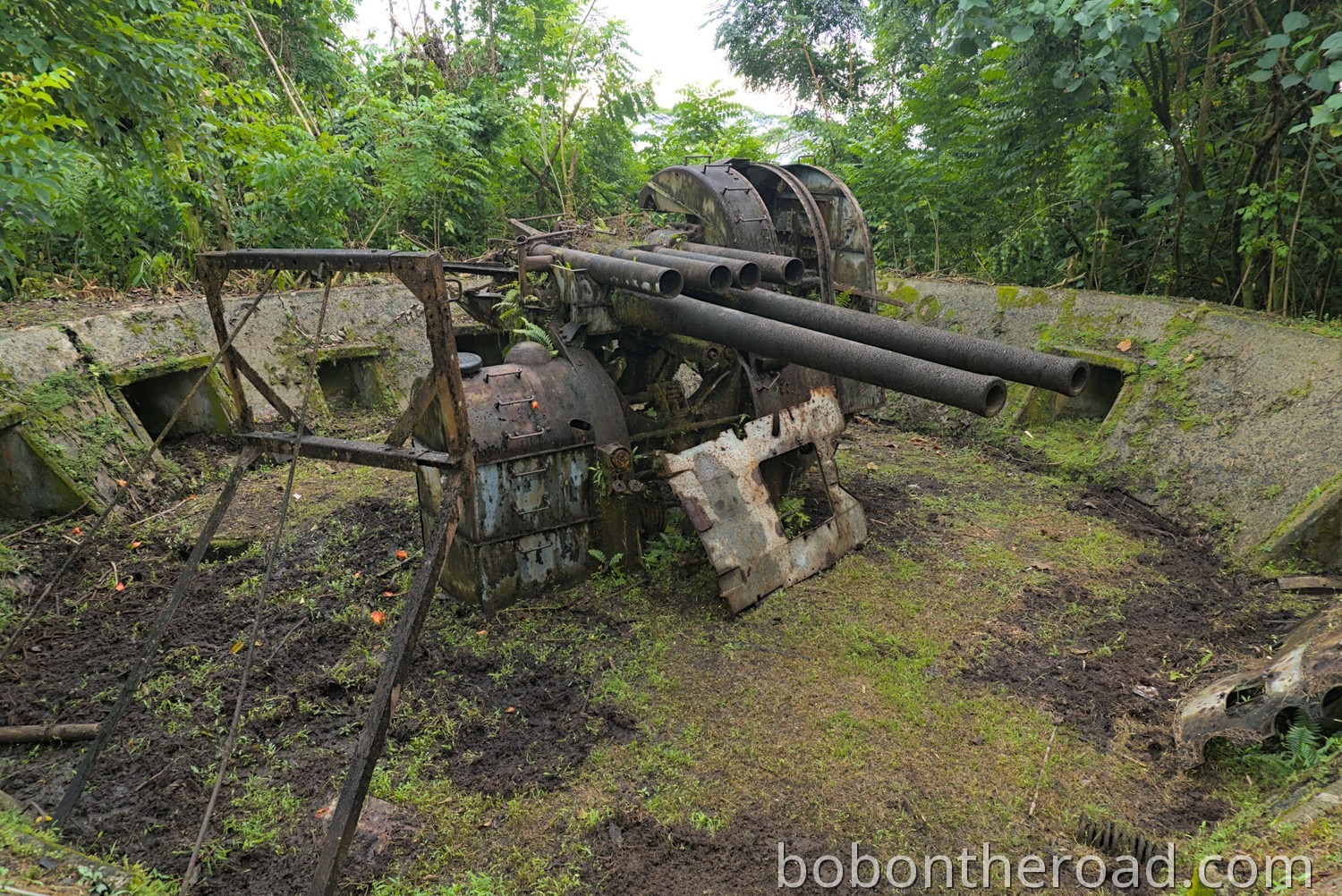
Japanese anti aircraft guns
There is a Japanese anti aircraft gun from World War II on Sokehs Mountain. A small road leads up the mountain. Halfway up, the road turns into a track, first gravel, then overgrown with grass. This section is relatively steep, and in rainy conditions it can happen that you cannot make it up with a car.
There is a viewpoint with a small parking area, marked on the map. From there it is another 500 meters on foot to the gun. The path is quite steep, but you get an excellent view of Kolonia and the airport almost the entire way.
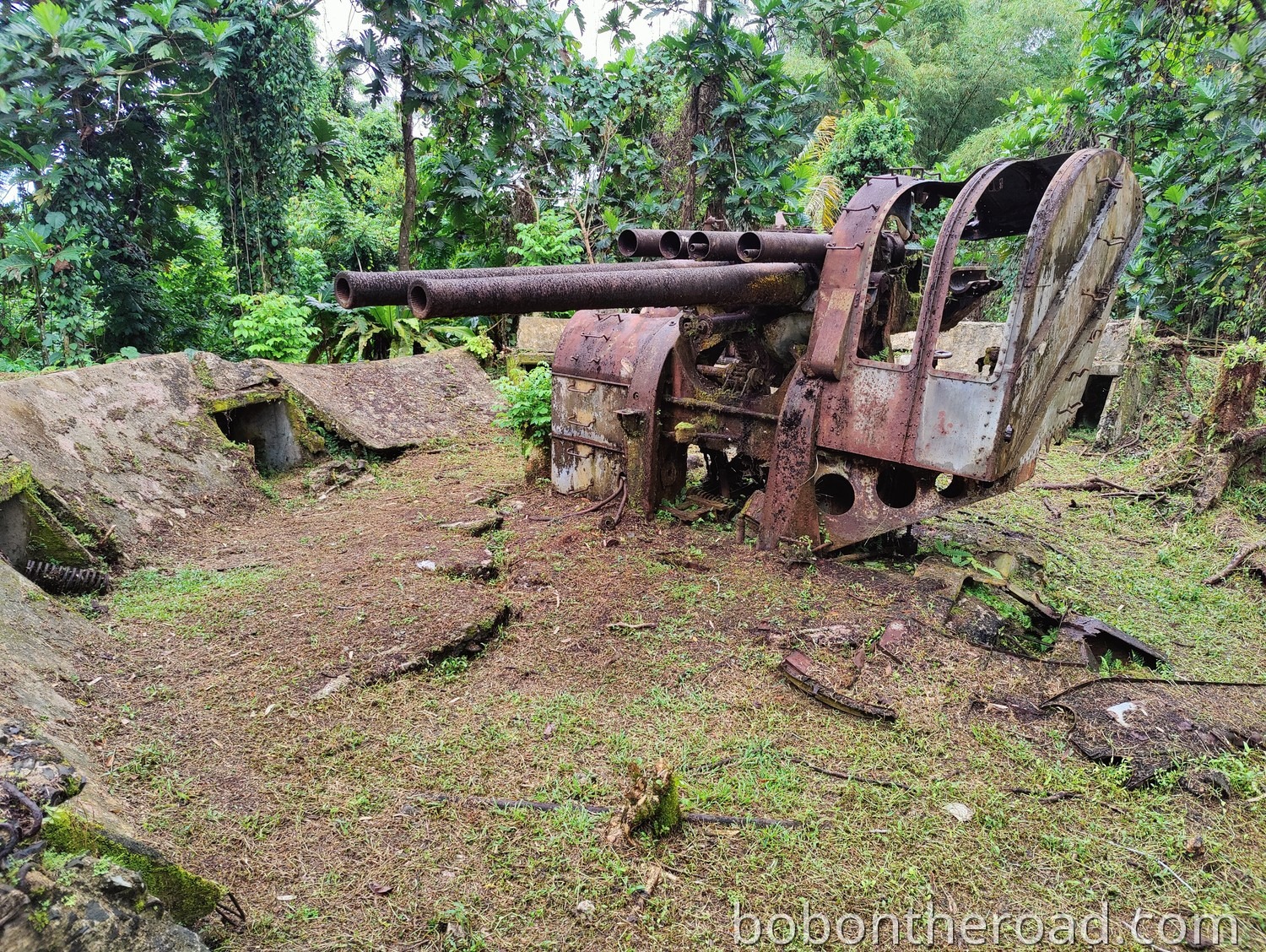
From the Japanese command post, a trail follows the ridge to another viewpoint.
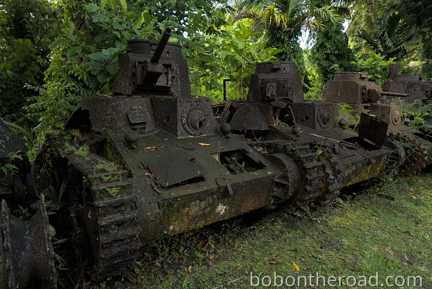
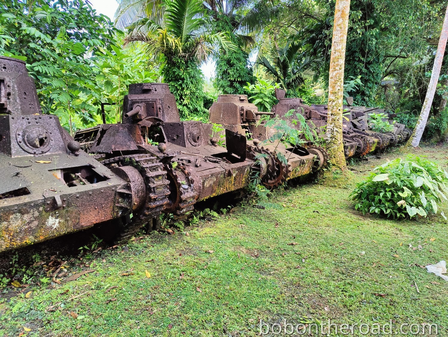
Tank graveyard
East of Kolonia there are about a dozen old, rusty Japanese tanks from World War II. The tanks are on private property, but the area is not fenced off and is freely accessible.
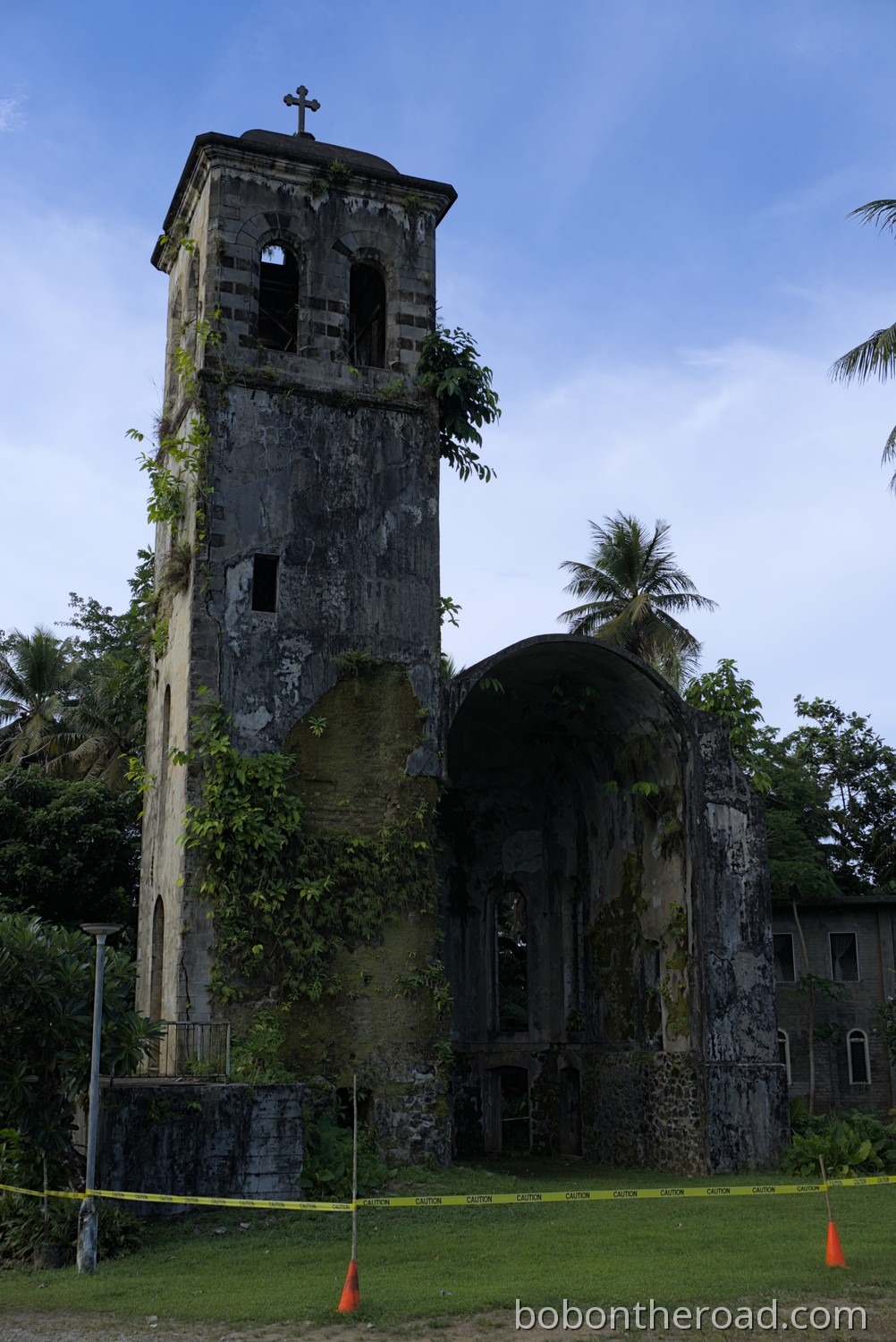
Ponape Bell Tower
The bell tower is a relic from the colonial era. It was built in 1909 by German and Spanish missionaries. At that time, Pohnpei was a German colony and part of German New Guinea.
At 20.7 meters tall, the tower is the largest preserved structure from the colonial period and is listed on the U.S. National Register of Historic Places.
Kapinale Church
Kapinale Church was built by the German Capuchin mission.
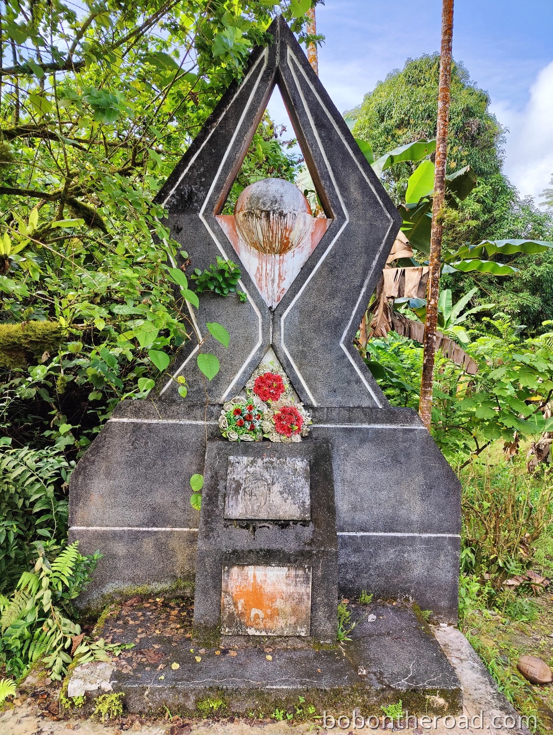
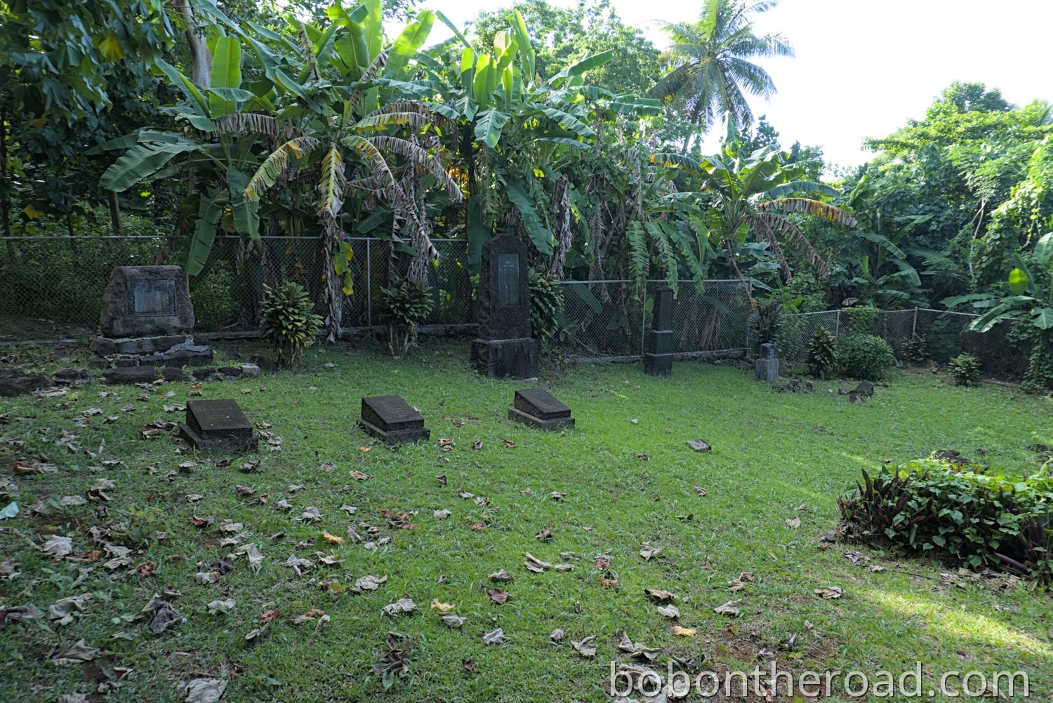
German cemetery
Directly behind Kapinale Church is the German cemetery. It was created by the German Capuchin mission and is registered as a historic site.
Capitol
FSM’s capitol is located in Palikir, the capital of the Federated States of Micronesia. “Capitol” does not refer to just one building, but the entire Capitol Complex, a government area with multiple buildings: the President’s Office, the courthouse, ministries, and other institutions. The complex was built in 1989, and at the same time Palikir became the new capital of FSM.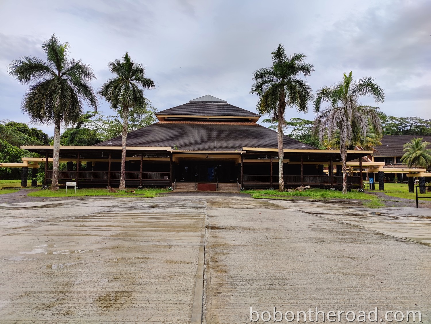
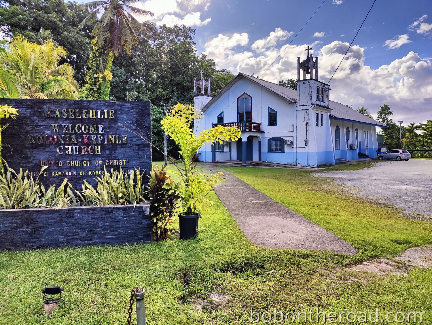
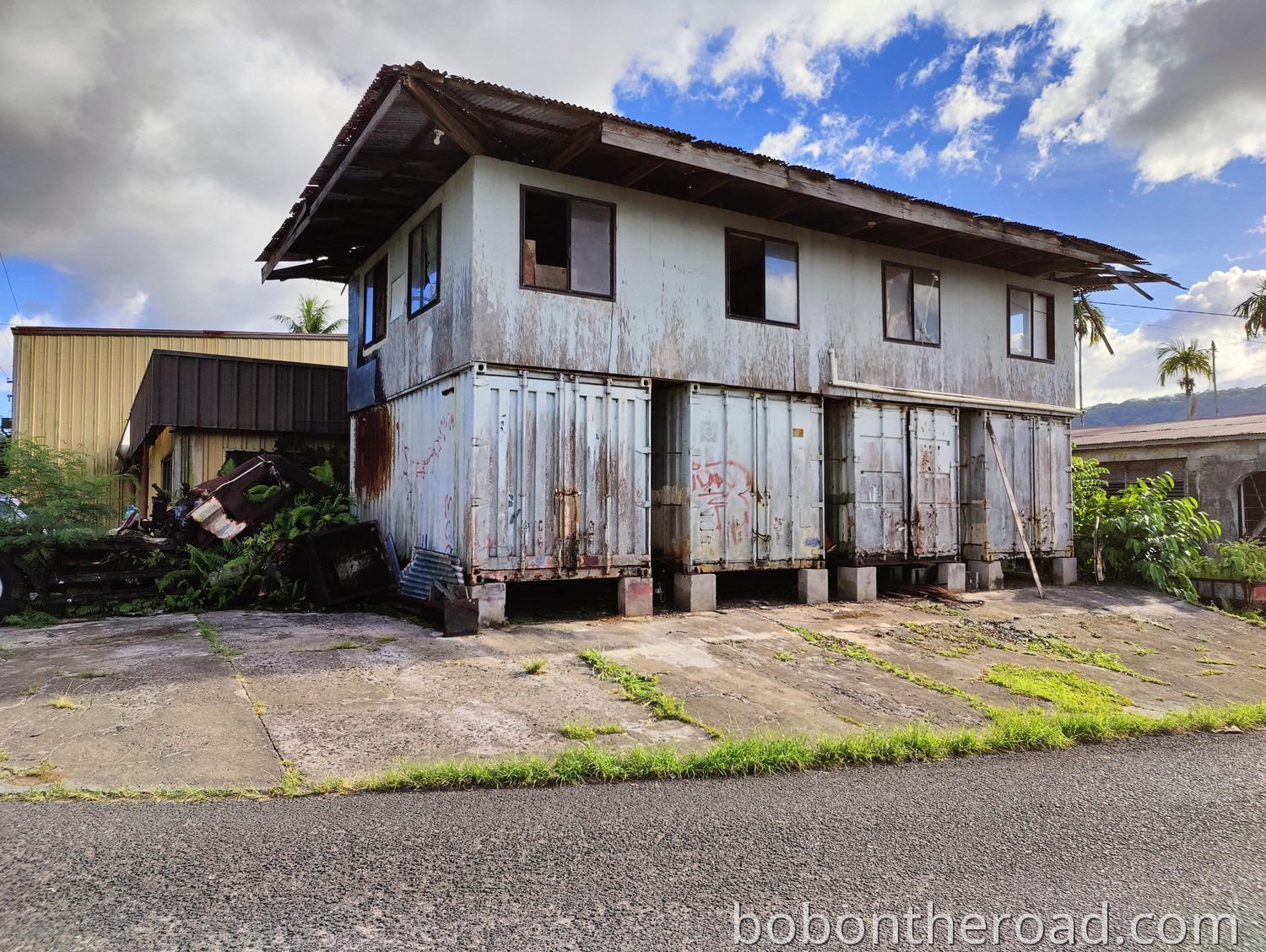
Kolonia
Kolonia was the capital of FSM until 1989, but it is still the most important and largest town on Pohnpei. Most hotels and shops, as well as the international airport, are located here. Many attractions such as the tank graveyard, the German cemetery, or the bell tower are in Kolonia. Even just walking the streets often leads to great photo opportunities.
Stray dogs are a problem in Kolonia. It is best to cross the street early so the dogs do not feel threatened.
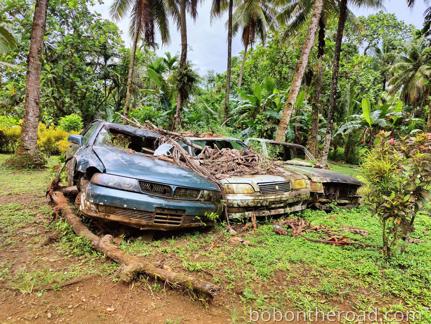
Car wrecks
All over the island, you will see many abandoned cars along the roadside. Some are barely recognizable because they are already heavily overgrown. The cars often make great photo subjects. In this case, the cars are nicely lined up in a row.
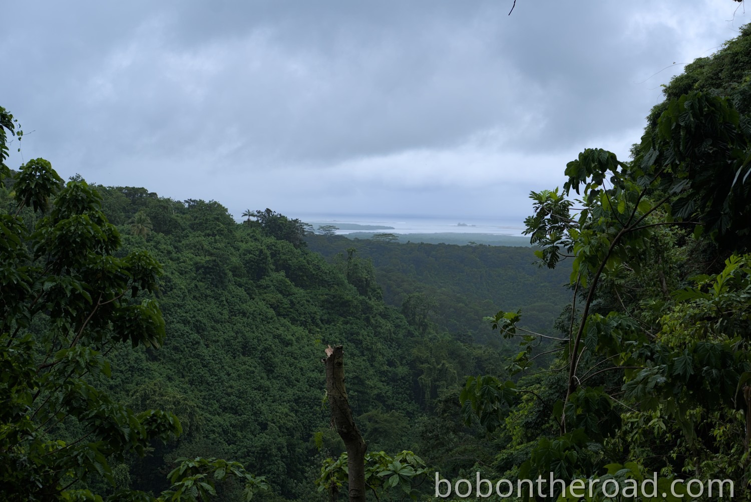
Rainforest
Pohnpei is covered in dense rainforest. A small clearing like this one offers a beautiful view across the island.
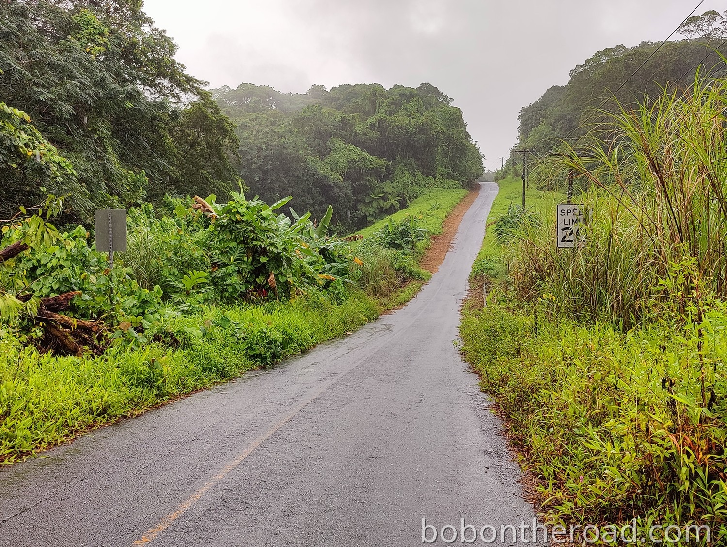
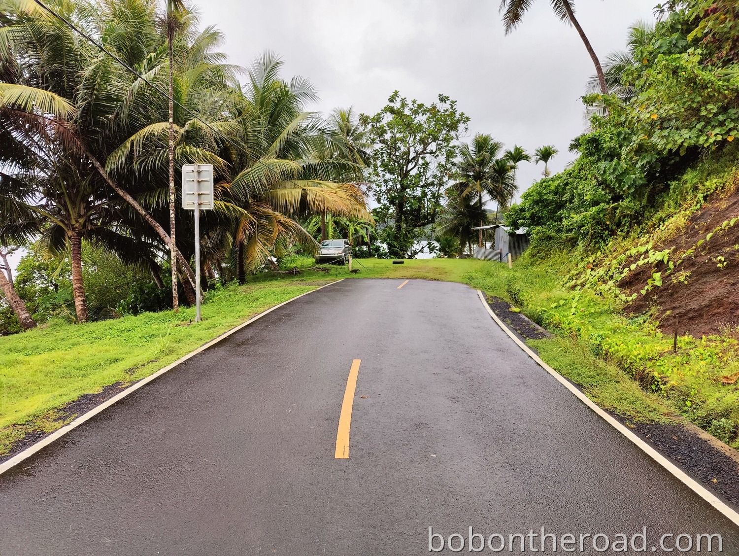
Road
The ring road on Pohnpei is busy and usually fairly wide. But every now and then Mother Nature shows who the island belongs to and leaves only half the road.
Side roads often turn within just a few meters from a wide two lane road into a narrow path where it is almost impossible to get through.
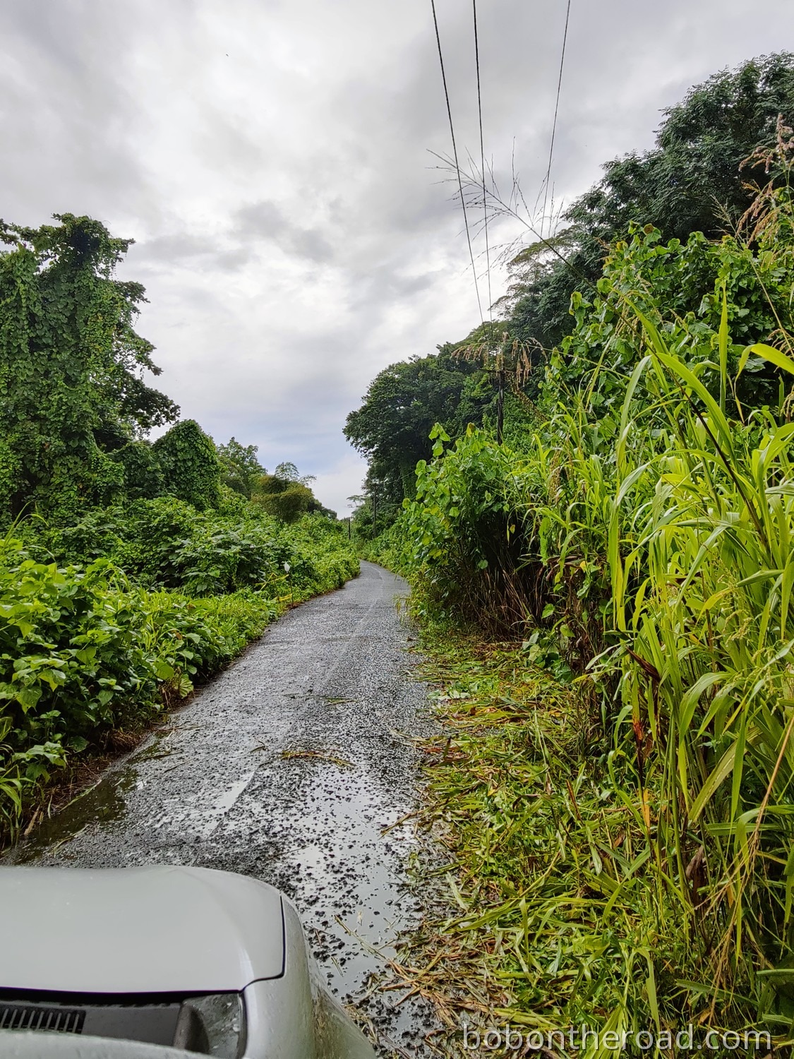
This road here is one of the best we saw on Pohnpei and suddenly it ends right in front of a house.


Comments
No comments yet. Be the first!
Leave a Comment